Moor Boots

Moor Boots is a scheme to assist young people from disadvantaged backgrounds to acquire personal expedition equipment allowing them to participate in activities from which they would otherwise be barred.

Moor Boots

Moor boots

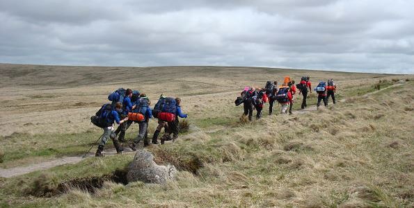
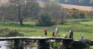
Duke of Edinburgh's Award Scheme walkers

Moor Boots is a scheme to assist young people from disadvantaged backgrounds to acquire personal expedition equipment allowing them to participate in activities from which they would otherwise be barred.

The project makes small grants to selected individuals allowing them to purchase personal items such as boots and socks from selected suppliers. The scheme is targeted at the Duke of Edinburgh's Award (D of E) scheme. It removes cost barriers to entry of the D of E scheme for disadvantaged young people. Potential applicants for grants are identified by D of E Assessors / supervising teachers. Candidates complete a simple application form which is accompanied by a supporting statement from the teacher / assessor.

Applications are adjudicated by an independent panel. Successful applicants are able to purchase equipment from designated participating suppliers. The D of E Award scheme provides an opportunity for young people to experience and learn about the Dartmoor landscape in an environment that places high value on developing teamwork skills and understanding the heritage and natural environment of the landscape.

The objective of the project had been to provide practical help to 75 young people over the course of the Scheme. By the fourth year of the five year project, twice that many grants had already been awarded.

Want to know more?

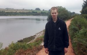
Speak to Philip Hutt, Director, Dartmoor Preservation Association
Tel: 01822 890646
Email: info@dartmoorpreservation.com

Read more

Related Articles

Potter's Walk Improvements

Existing trails at Fernworthy Reservoir are being upgraded; which will allow access to some parts of the Lake to those who are less agile. Kit Hancock, South West Lakes Trust local Warden, visited Fernworthy last Friday to check the progress of the contractors, ‘Landmarc’, who are undertaking the work. Kit said, “It is great to see Potter’s Walk almost complete and usable again. This short, lakeside walk has always been popular with many people. Landmarc are a good company to have on the job as they have been only too willing to work with us and the Park to protect hut circles near the trail and keep things neat and tidy as they go, which will help the path naturalise quickly.” Looking ahead they will shortly be working on reinstating the permissive footpath through the felled woodland and woodland to the bird hide; then making the path and steps below the dam easier to negotiate. Apart from the odd stream crossing, boardwalk improvements and soft spot, everything else between the bird hide right round to the dam will be kept much as it is, making it easier to negotiate but without running a track right round. Potter’s Walk, which should be fully open in October, is a circular route of about ¾ of a mile, suitable for disabled users and those less agile. It has resting places and some slopes which some may require assistance. The walk is named after Sydney Potter who lived and worked at Fernworthy for over 50 years. More information about the project is available here Moor than meets the eye is also developing a Heritage Trails interactive web map to help visitors plan their visit to the moor. It will allow visitors to choose a route from a list or submit their own and will provide information about features of historic or wildlife importance.

Read more

Fernworthy LiDAR Day

LiDAR mapping is a relatively new technique to enable digital aerial photographs to be taken of the landscape. It has great potential to help archaeologists explore the landscape and look for clues of previous human inhabitation. During the development of the scheme we surveyed Fernworthy, Bellever, Soussons and the East Dartmoor NNR. The LiDAR is able to see through the woodland canopy and map the forest floor to enable us to see a landscape without trees. We met with an enthusiastic group of volunteers on Thursday 23rd April to look at some of the maps produced by LiDAR and to try out the technique of "ground truthing". We had identified features we already knew about from the HER and marked them on the LiDAR maps and we also highlighted potential features. The day was an attempt to match up the mapping with features on the ground to see what things were picked up- how big a feature might have to be- how easy it might be to miss features. The day proved to be very interesting - sadly we didn't discover a new hut circle! but we did identify the continuation of some wall features- all of which is potentially very exciting. The next step will be to develop the project into a formal survey and to help potential volunteers develop skills to manipulate the LiDAR data and to survey it on the ground. If you would like to find out more or get involved please contact Andy at andy@moorthanmeetstheeye.org A big thank you to all those who came along on the day.

Read more

Bellever and Postbridge Trails

Proposals for trails, interpretive media and visitor management (including car parking and landscape proposals for the forest area) which make links around Bellever Forest and Postbridge, using Whitehorse Hill as a means of developing further interest in the heritage of the area. An Access and Interpretation Plan was commissioned to set out what the community would like to see happen in the area.

Read more

Last update: 06 Apr 2018 3:40pm